It’s been a long time since I posted last, but now that hiking season has begun, I will now post regularly. I’ve been doing training hikes, but I never take pictures on those because all I do is condition my legs without stopping for pictures. Now, though, I’m hiking for fun and I will always stop for pictures.
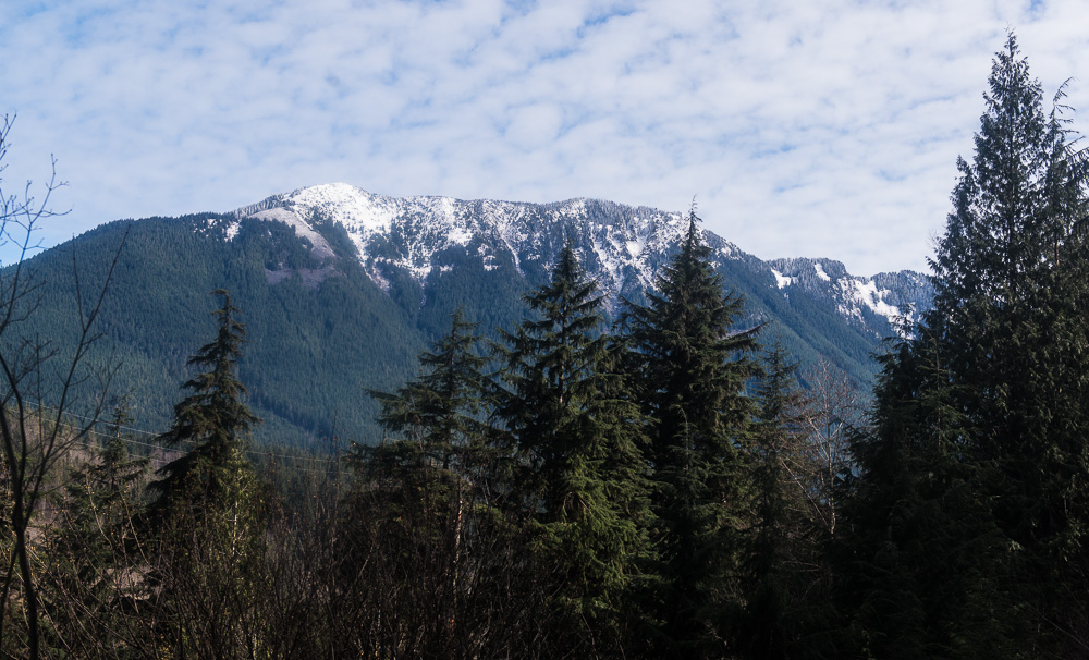
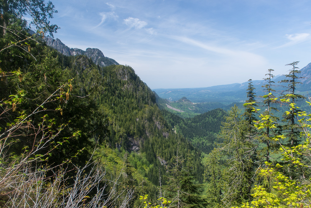
My first hike was actually by accident. I wanted to hike up Mt. Si, but the parking lot was completely full. So, I went across the valley to Iron Horse State Park. This is an unusual park. It is about 100 miles long and 10-20 feet wide. As you might guess from the name, it used to be a railroad track that went from North Bend, WA to the Columbia River in eastern Washington. The state bought the land, tore out the tracks, and made it into a park. It’s a wonderful trail for early season hiking, because it has a gentle grade and there are no obstacles for many miles.
I hiked about 10 miles that day. There are a lot of vistas to see from the trail, and it was a very pleasant first fun hike. The hike took place on the last weekend before spring officially started, and the spring flowers were just barely getting started. I’ll have to go back at some point. There were a fair number of side trails to explore.
In the meantime, here are some pictures. Enjoy!
Near the start of the trailRattlesnake Ridge, a popular (i.e. crowded) hiking destination.
Closeup of Rattlesnake Ledge. If you look closely, you can see the mobs up there.I don’t normally include man-made objects, but I made an exception for this. The power lines make great leading lines.I love the many shades of green in this shot.An abstract look at a flowering plant.When I saw this, I felt the urge to climb that mountain!
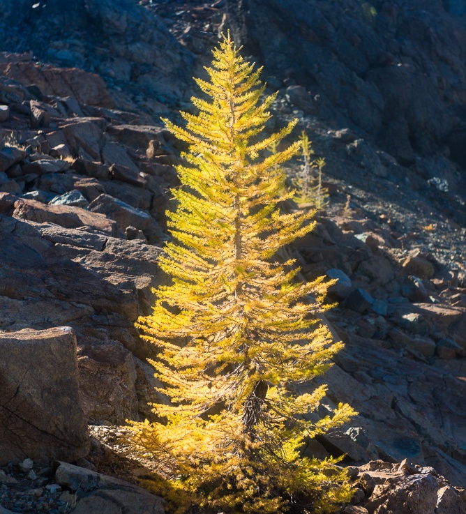
Larches are the only coniferous trees that act like deciduous trees. Every autumn, their needles first turn golden, then orange, and then they fall off. Golden larches are gorgeous!
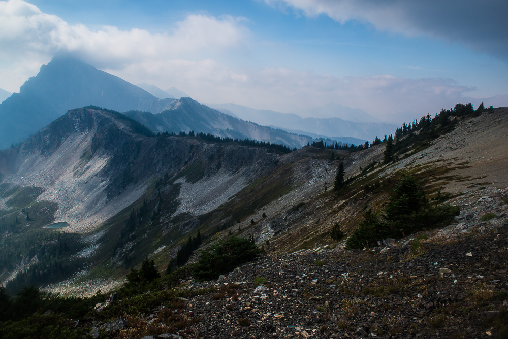
However, most larches in Washington state grow only at high altitudes (6,000 feet and above), so you need to hike to see them. So, last weekend, I did just that. I drove over to eastern Washington (northeast of Cle Elum), and set out for Ingalls Pass. It’s a somewhat strenuous hike (you gain 2,500 feet in 3 miles), but the view is so worth it! Ingalls Pass is at 6,500 feet, and you can see forever.
Here are the pictures:
Closeup of leaves with autumn colors.One of the Esmeralda Peaks as seen from the trail.The blueberry bush leaves turn bright red this time of year.My first sight of larches!
Mt. Stuart
Headlight Basin (no idea how it got that name). The distant peaks on the right border the Enchantments.
On day 7, we decided to camp at Hart’s Pass (a 17 mile hike) instead of one 10 miles away. There was a method to our madness. You may recall that we were supposed to start at Hart’s Pass, but we had to change the route due to possible wildfire danger near the Pacific Crest Trail (the PCT was reopened after a few days). So, we had to park at a trailhead which was 10 miles away from Hart’s Pass. We were hoping that we could catch a ride, so that we didn’t have to hoof it all that way (we’d already hiked 70 miles).
So, we got up fairly early, just went for it. One thing that helped my hiking speed was the weather. It rained all morning, so I didn’t stop for many photos. However, once the clouds rolled away, everybody slowed down to admire the views.
Eventually, we got to Hart’s Pass, and set up camp. I went to bed as it got dark. Fortunately, two of my companions stayed up. They flagged down a car! Since I was already in bed wearing almost nothing, I gave my keys to one of them. It was late after they brought the cars up, so we decided to stay the night anyway.
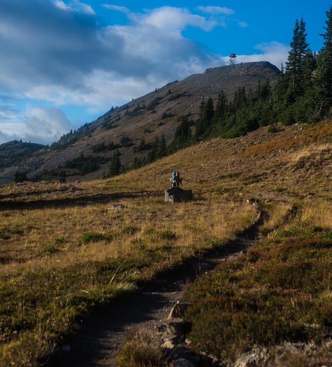
On day 8, we packed up for the last time, and drove 3 miles to Slate Peak, the highest point you can drive to in Washington state (7,200 feet). There’s a closed fire lookout at the summit (7,334 feet), not to mention 360 degree views!
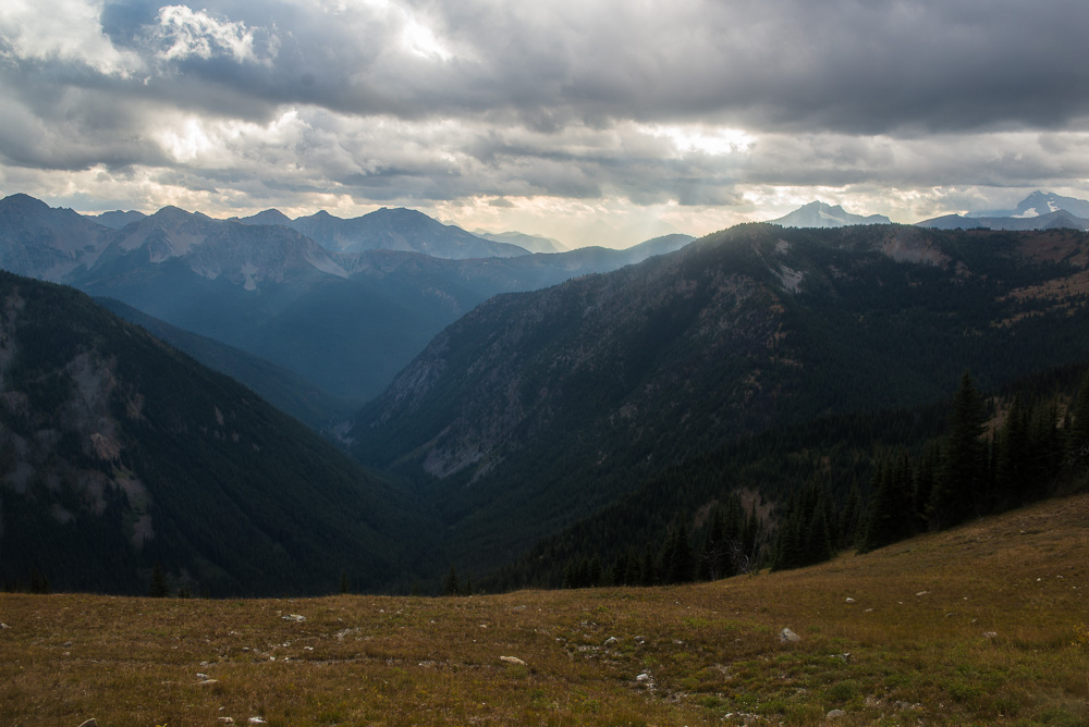
Following that highlight, we headed home. Our route was still affected by wildfires, though. Highway 20 through the Cascades was closed, so we took alternate route (US 97 and I-90). On our way south to Wenatchee, we had to drive through a place that had burned recently. It’s been a bad year for wildfires. After Wenatchee, everything was routine, aside from the smoke. I thought that the air would clear after we got into western Washington, but it didn’t. I am glad that wildfire season is over now.
Enough serious stuff! Here are some photos.
CloudsMore cloudsThe sun peeped out for a bit.Fall colors are already out in August!
Colors!I love this shot!I took this shot while were were getting water from one of the very few creeks along the trail.The clouds are rolling away.Looking west at the North CascadesWe’d been hiking along the left ridge. We’re getting fairly close to the end.Just another PCT vista.I love the light and shadows in this image.Looking west at the sunbeamsSilver Star MountainGetting close! That’s the first view of the Slate Peak lookout.Looking southwest.I like this one. It has the trail, a hiker, and the lookout.Mt. BakerThe trail up to the lookout, my Jeep, and Silver Star in the background.A wider view from the summit of Slate Peak.Our other car arrives.Looking north from Slate Peak. To the left, you can see the PCT. The snowy mountain on the right is Castle Peak, near the Canadian border.Forgive the “artsy” picture. I like the textures.Slate Peak lookout, and Mt. Baker in the background.
In my opinion, day 6 was the best day of the hike. I got up early, so that I could get some shots with morning light. That worked beautifully! I got the expected landscape shots, then I went after the unexpected ones.
Hopkins Lake and the North Cascades are so remote, that the animals have not learned to fear humans. Deer, for instance, simply ignore us (as long as we keep our distance). So, I just followed a deer as it was grazing. Then it encountered a grouse. You’ll just have to look at the pictures to appreciate it.
Eventually, the others awoke and packed up. We left Hopkins Lake, gained about 1,000 feet in a few miles, and hiked Lakeview Ridge. What a view! At 7,100 feet, we were at the highest point on the entire hike. I won’t try to describe it. Just look at the pictures! This is why the Pacific Crest Trail became a national scenic trail.
There was one down side to hiking a ridgetop. Water became scarce, and would remain so for the rest of the hike. Fortunately, I had already researched PCT water locations back home. It was a little tight every now and then, but we managed to stay hydrated.
On to the pictures!
Early morning cloudsWe hiked to the top of the ridge later that dayLove the shadows and textures.
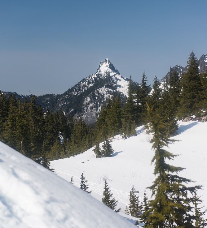
A deer spots a grouseDeer asks the grouse “What are you?”Deer wandering aboutDeer wandering through our campsite (that’s my tent).Hitting the trail, and gaining elevationThe “Devil’s Staircase”. It wasn’t as steep as I thought it would be.Looking north from the PCT. Canada is about 6 miles away.Looking back at the way we came.The high point of Lakeview Ridge (about 7,100 feet). Yep, the PCT follows the ridge.Hopkins Lake. It’s obvious why this is called Lakeview Ridge.Just following the ridge (and admiring the views).Mt. Winthrop. Some smoke from a distant fire has blown in.Looking back (north) from Lakeview Ridge. I love the way that the ridge continues into the distance (a leading line).Gaining some serious altitude nowThe views are really opening up now. This is looking north.Looking northwest. I love the light and the shadows!We’re almost to the top now.At the top (7,100 feet). We’re looking northeast at Hopkins Lake and the Pacific Crest. I think the dip in that ridge is Frosty Pass.Looking south at Lakeview Ridge and Three Fools Peak. This is one of my favorites.Three Fools Peak and a PCT hiker.Three Fools Peak. Fortunately, we didn’t have to climb it.Lakeview Ridge looking south. Three Fools Peak is in the background.This is typical PCT. You gain (and lose) a lot of altitude, but you do it fairly gradually.Looking west at some serious smoke. The fire was at least 50 miles from us.Gradually climbing to Woody Pass.Approaching Woody Pass. I like this photo’s composition.Woody Pass is pretty high (6,624 feet).Woody Pass. A lot of wood, eh? 🙂From Woody Pass, we see the next pass, Rock Pass. As usual, we lose some elevation and gain it back.If you look carefully, you can see the PCT and its switchbacksAlmost to Rock Pass. Holman Peak is in the background.Looking back at Woody Pass.Just about to the top of Rock Pass.Found a campsite with water, and then I wandered with my camera to capture the golden hour.I like the colors in this one.Just about sunset.Our tents were in the treesAs usual on the PCT, the deer have no fear of us.Clouds!
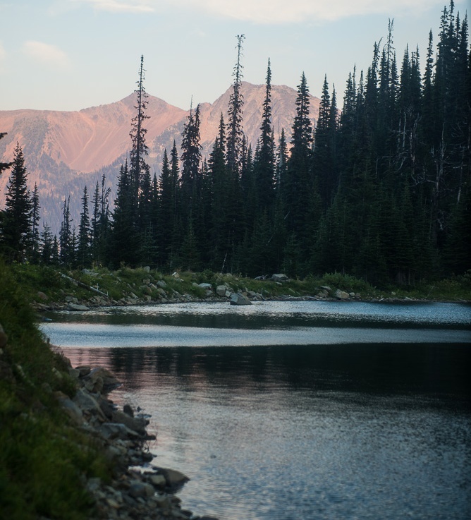
On day 5, we hiked south on the Pacific Crest Trail for only 3 miles, and set up camp at Hopkins Lake. Everybody agreed that a rest day was welcome. Besides, the lake and the scenery were beautiful, so it was pretty easy to stay put.
I’m not the type to lay in the sun, so I explored around the lake. I didn’t go all the way around, because it was so pristine that I stopped after the bootpath faded away (I didn’t want to make a new path).
This place is so remote that the animals have not learned to fear humans. One doe wandered near and through our camp without a concern. After the sun went down, I laid down on the grass to watch the stars come out. When it was almost completely dark, I heard a rustling noise. I looked up at a buck with a huge rack of antlers who was about 10 feet away from me. I slowly got up, talking softly, and backed away.
BTW, I looked at the stars later. There weren’t as many as I expected, because they were obscured by the haze of a distant wildfire’s smoke. FYI, we were never near any of the wildfires.
On to the pictures!
Looking northwest from the PCT. I believe the snow capped mountain in the background is Castle Peak.Mount Winthrop (wide view)Mount WinthropLooking west from the PCTHopkins Lake
Hopkins Lake, with Lakeview Ridge in the background. We would hike that ridge the next day.I took this shot directly opposite from our campsite. The hill is called the Devil’s Staircase. We hiked up that the following day.
Golden hour. The hour before sunset when the sunlight becomes golden.Sunset approaches. See the smoky haze in the background?
Day 3 was a Monday, but for some reason I didn’t mind. 🙂 We broke camp, and immediately forded a river (Middle Fork Pasayten River). We knew for sure that we were in the wilderness, and that’s a good thing!
After a few miles, we crossed the West Fork, but this time on a bridge. Shortly after that, we found ripe blueberries! After snacking for a bit, we pressed on and arrived at the abandoned Pasayten Airstrip (motors are not allowed in a wilderness, unless it’s an emergency). There is a ranger station there, as well. Nobody was there, but that was okay. There was a real privy! We stopped for lunch, and let our tents dry out (there’s lots of moisture and condensation when you camp next to a river).
After that, we soon found the boundary trail, #533, and headed more or less northwestly on it. We camped a few miles short of Frosty Pass (we hiked about 10 miles that day).
On day 4, we broke camp and gained about 2200 feet in about two miles as we headed up and over Frosty Pass. It was worth every drop of sweat! As we gained altitude, the views got better and better. This is what we had come for!
After Frosty Pass, we got on the Pacific Crest Trail, and camped a few miles later at Castle Pass. The plan was that we would then day hike up to the Canadian border (7 mile round trip), but I didn’t go. Frosty pass kicked my backside, so I stayed behind and rested.
Now, how about some pictures?
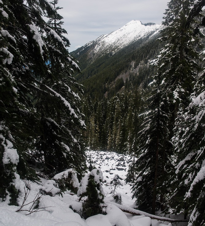
Bridge over West Fork Pasayten RiverPasayten AirstripRanger station at the airstripPoint DefianceDead LakeDay 4 now. We’re looking up the valley at Frosty PassThis stream was an unexpected pleasure.Looking northeast at the way we had comeI don’t know the name of the ridge, but it sure is beautifulThat dip is Frosty PassI love the shadows and the textures in this image.At the pass! We’ve looking northeast. We hiked all the way up the valley.Looking north a Mt. Winthrop, one of the taller mountains in the neighborhood (7850 feet).
I led my most ambitious hike ever last August. As planned, we would hike 62.5 miles in the very remote Pasayten Wilderness in 8 days. I planned everything out in detail. We would start at Hart’s Pass, and hike about 27 miles up the Pacific Crest Trail (PCT) to camp just a few miles away from the Canadian border (we’d day hike to the border). Then, we would take the Boundary trail (#533) southeast to the abandoned Pasayten Airstrip. The last leg would be on the Buckskin Ridge trail (#498), which parallels the PCT, and would end about 1/2 mile from our starting point.
Unfortunately, I had to scrap most of my plans, because when we arrived the PCT had been closed due to wildfire danger. So, I consulted the map, and came up with a new route. It turned out to be longer (70 miles) than the original plan, but it still was an epic hike; definitely one of the better hikes I’ve been on.
The new plan had us start on the Robinson Creek trail (#478). After 20 miles, we would arrive at the Boundary trail junction at the Pasayten Airstrip. From there, we would do the rest of the hike as planned, but in the opposite direction.
This post will cover those first 20 miles. One disadvantage of the new trail was that it is mostly in valleys, so there aren’t many vistas. As a consequence, this post won’t have many pictures. Trust me, though. There are plenty of pictures for the other days.
Enjoy!
We entered the Pasayten Wilderness early on the trailFirst vista. I believe that this is Robinson MountainWe had a swimming hole at our first campsite!
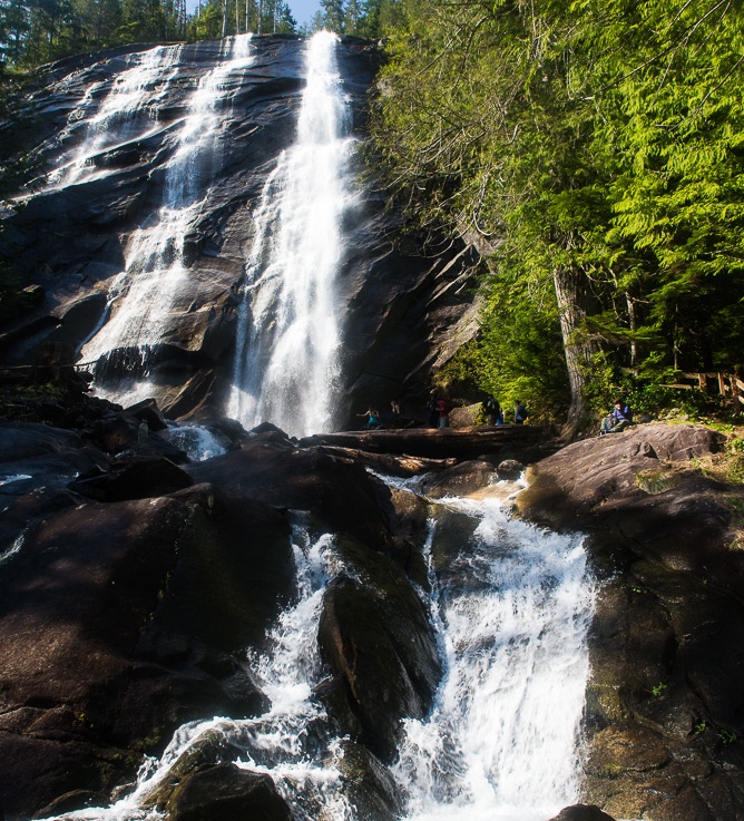
I led a relatively easy hike last weekend. We drove up US 2 to Index, and hiked up to Bridal Veil Falls, one of the taller waterfalls in Washington state. After that, we climbed a LOT of steps and rocks to Lake Serene (the falls gets its water from there).
The Lake is serene, but the trail is so popular that the shoreline wasn’t. Oh well. It was a pleasant sunny day. The temperature in the upper 70s, so a lot of the males had their shirts off.
As usual, I brought up the rear. Every time I’d get my stride, something beautiful would catch my eye and I would stop to take a picture. That makes me a really slow hiker, but it does mean that you get to see what I do. Enjoy!
Backlit tree and moss
Salmonberry blossom
I think these insects are mating, so this is bug porn! 🙂View to the north (central Cascades)
Bridal Veil Falls
Looking down the falls
MossThe falls are visible from the trail to Lake Serene
The views are starting to open up.
Mt. Index. Almost to the lake!Skykomish river valley.Lake Serene. A little bit of Mt. Index is in the background.
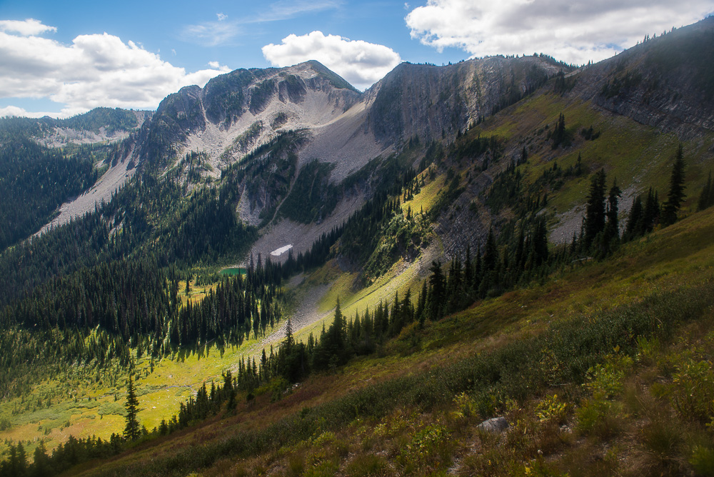
I hiked up to snowy Mason Lake last weekend. The original destination was Bandera Mountain, but there were hordes of people going that way. So, like Robert Frost, I took the road (okay, trail) less traveled to Mason Lake.
I’m actually glad that I took the alternate trail because of its history. The Ira Spring trail is named after a strong advocate for trails. Ira spent his life encouraging people to get out on the trails. He also did quite a lot to get funding for new trails and to maintain the existing ones. Ira passed away in 2003, and was buried in a boulder field next to the trail. The burial site has a memorial plaque and an excellent view of Mt. Rainier.
It was a decent day in terms of weather. It was clear enough that you could enjoy the view. The only downside was that Mt. Rainier’s summit was hidden by the clouds, but that was good enough.
Mason Lake was uncrowded, as expected. I ate lunch and drank in the view. I did have to be careful not to sit under the trees, because they were dropping snow bombs. Not a bad day overall.
Now the pictures:
McClellan Butte as seen from the trailhead
WaterIt’s springWater on needlesWater dropletsThe snow started getting serious at about 4,000 feet elevationI-90 and the Snoqualmie valleyThe clouds over Mt. Rainier’s summit briefly parted.McClellan ButteThe Ira Spring memorial plaque and a little piece of the view.
Mason LakeReflectionI think this is Dirty Harry’s Peak. No, this Harry was merely filthy all the time. 🙂
Last weekend, I wanted a hike that (a) had a fantastic vista and (b) would be strenuous enough to count as a conditioning hike. Granite Mountain definitely met those criteria.
So, off I went. I got a relatively late start, but I managed to get a parking space. Granite Mountain, like most trails on the I-90 corridor, gets a bit crowded on sunny weekends.
I normally don’t bring a camera on a training hike, but I made an exception for this one, because the views are exquisite! The only slight problem was a haze caused by massive wildfires in Siberia. I’m not complaining, though. Over 1,000 Siberian homes have been destroyed or damaged, and 15 people have died due to the fires.
The hike started in the forest, and I noticed that the wildflowers are beginning to blossom. There wasn’t any snow until I got above the treeline (about 4,000 feet). The snow was fairly shallow until I got to about 5,000 feet. After that point, you had to stay on the packed snow. If you didn’t, you sank to your waist in the snow.
I almost made it to the summit, but I turned back with about 300 vertical feet and 1/4 mile to go for two reasons: (1) the snow started getting very slippery and (2) it was getting late (4 PM) and I did not want to use my headlamp on the way back.
That’s the nice thing about mountains. They’re not going anywhere, so you can always come back another time. 🙂
Here are a few pictures.
Flowering strawberry plantsTrilliumYellow VioletFirst vista on the trail. We go much higher than this!Looking westWe’ve still got to gain a lot of altitude.Looking east.First glimpse of the fire lookoutMt. Rainier. The haze is from massive Siberian wildfires.An artistic look at Mt. Rainier.Looking down at Lake Keecheelus on the other side of Snoqualmie Pass.The lookout is getting closer.“The tooth”. Also known as Kaleeten Peak.The lookout. I turned back not long after I took this shot.